NeometricoNeometrico
PlatformTechnologyPricingGAIA AIZeusLive
About
Login
← Back to the blog

Blog tag

Posts tagged #How-it-works

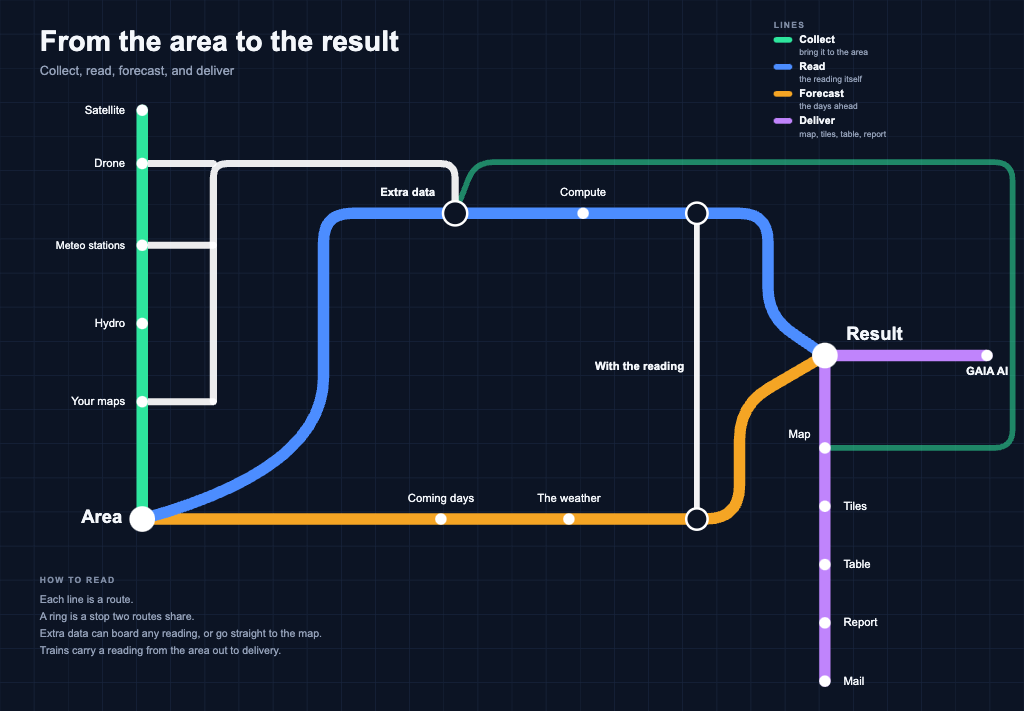
  • Transit-style map with four lines: Collect, Read, Forecast, and Deliver, from Area to Result, with GAIA AI.

    How it works3 November 2026

    Neometrico architecture as a transit map

    How Neometrico is built, as a transit map: collect data on an area, run the reading, add the forecast, and deliver map, tiles, table, report, mail, and GAIA AI.

    Read →
NeometricoNeometrico

Satellite, drone and stations for farms, towns and operators. Built in Valencia.

Platform

  • Air Mapper
  • Mission Control
  • Meteorological stations
  • TrueWind
  • Urban Climate Index
  • River Pulse
  • Methodology
  • GAIA
  • Zeus Orchestrator
  • Live
  • Integrations
  • Solutions

Sectors

  • Agriculture & Livestock
  • Smart Cities
  • GeoINT

Company

  • About Us
  • Vision
  • News
  • Blog
  • Team
  • Contact

Connect

  • LinkedIn
  • X
  • Instagram
We participate in the incubation program funded by:
SkyLabImpulsaCámara de EspañaCámara de Comercio de ValenciaUnión Europea

© 2026 Neometrico. All rights reserved.

Privacy PolicyCookie Policy

For farms and towns — not only central administrations.