
14 September 2026
Bornova Smart City Pilot: Mapping Urban Heat Islands with Satellite Data & GIS
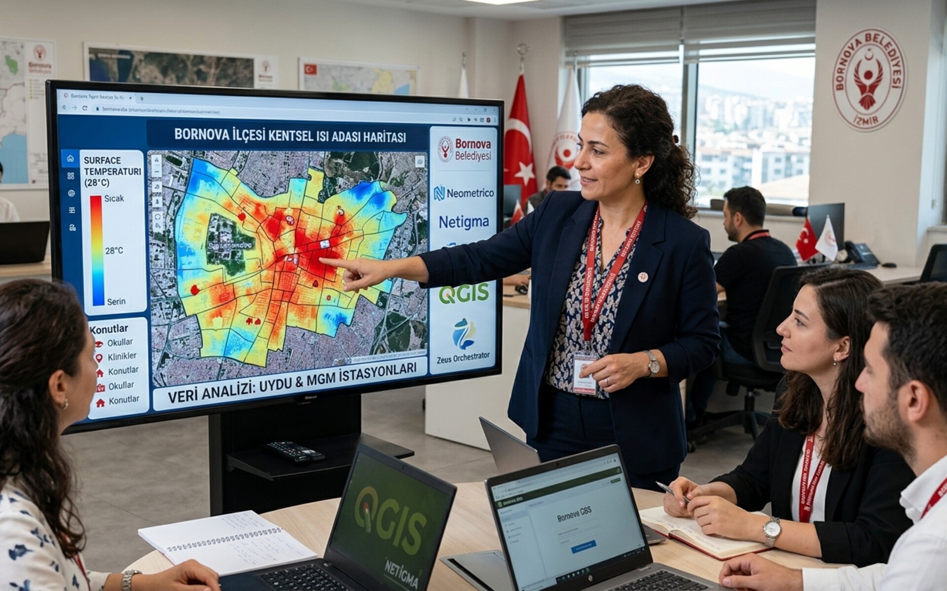
Neometrico has launched a pilot project with Bornova Municipality in İzmir, Türkiye. The work maps Urban Heat Islands (UHI) across the district: where surface temperature is higher, from satellite imagery and MGM station data. Fatma Mesutgil, Director of Climate Change and Zero Waste, leads the study. Results enter the GIS the municipality already uses, Netigma and QGIS.
Spanning about 220 square kilometres and 45 neighbourhoods, Bornova is home to some 452,000 residents and to Ege University’s main campus, the first university in İzmir.
Urban Heat Island Mapping for Bornova Municipality
This Urban Heat Island (UHI) map for municipalities shows where surface temperature concentrates in Bornova. The output is a live GIS layer the district can use in SECAP reporting and in academic or international climate work.
Integrating Satellite & Station Data into Municipal GIS (QGIS & Netigma)
Satellite imagery and MGM station records enter a single analysis, so the surface temperature layer is enriched with the air the stations measure, as described under Meteorology. The layer is published as XYZ and WMS tiles in the GIS the municipality already uses, Netigma and QGIS: a manager pastes the URL once and each new analysis updates the tiles through Integrations.
Supporting Climate Resilience and SECAP Action Plans
Weekly reporting is streamlined through Zeus Orchestrator as a PDF in the inbox, while the GIS already holds the same layer. The platform interface is in Turkish, so the team in Bornova works in their own language.

Fatma Mesutgil →Director of Climate Change and Zero Waste
Talk to us about your municipality
Climate teams in other municipalities can run the same analysis. Write to us with the area. We set up the map and the weekly report.
Talk to us